


More Snow, Wind Coming to Region, Bitter Cold to Follow
*National Weather Service La Crosse……WINTER STORM WATCH IN EFFECT FROM MIDNIGHT THURSDAY NIGHT THROUGH SATURDAY MORNING…
Mitchell-Howard-Winneshiek-Allamakee-Floyd-Chickasaw-Fayette-Clayton-counties in northeast Iowa
*National Weather Service Des Moines……WINTER STORM WATCH IN EFFECT FROM 9 PM THURSDAY EVENING THROUGH MIDNIGHT FRIDAY…
Emmet-Kossuth-Winnebago-Worth-Palo Alto-Hancock-Cerro Gordo-Pocahontas-Humboldt-Wright-Franklin-Butler-Bremer-Webster-Hamilton- Hardin-Grundy-Black Hawk-counties in north/north central Iowa.
From the NWS in LaCrosse:
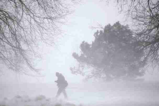
Another significant winter storm is expected to cause travel impacts from late tonight into Saturday across the region. Besides the potential for heavy snow, winds will be on the increase, leading to blowing and drifting. There could also be pockets of whiteout conditions, especially in open areas.
Currently a broad swath of 6 to 10 inches is forecast, but those amounts could change based on storm track and amount of moisture the storm has to work on. There is still the possibility or higher amounts if bands move repeatedly over the same areas.
Widespread travel impacts should be planned for Friday into Saturday. Near white-out conditions could develop at times Friday into Saturday morning as winds gust upwards of 30 to 40 mph. Consider altering, delaying or even canceling travel plans if conditions warrant it.
Bitterly cold air arrives as this storm system exits the area. This will lead to wind chills of 20 to 30 below by Saturday night.
For the latest Iowa road conditions, check www.511ia.org , where you can also download the the 511ia app.