



⚡Two Rounds of Severe Weather Possible in Iowa Late Tonight and Friday
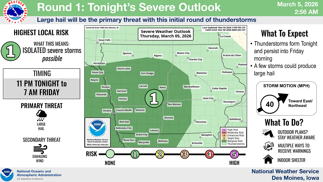
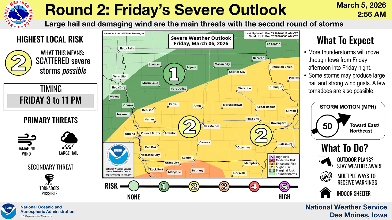
DES MOINES — The National Weather Service says Iowa could see its first severe weather threat of the year, with two rounds of thunderstorms possible late Thursday night through Friday night.
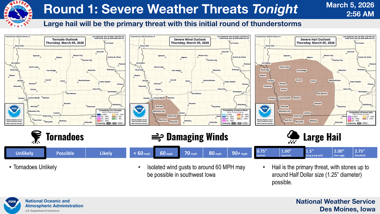
According to forecasters, the first round of storms is expected to develop late Thursday night, mainly after 11 p.m., and continue into early Friday morning. The primary threat with these storms will be large hail, with some hailstones potentially reaching up to half-dollar size. Isolated wind gusts near 60 miles per hour may also be possible, mainly in southwest Iowa. Tornadoes are considered unlikely during this initial round of storms.
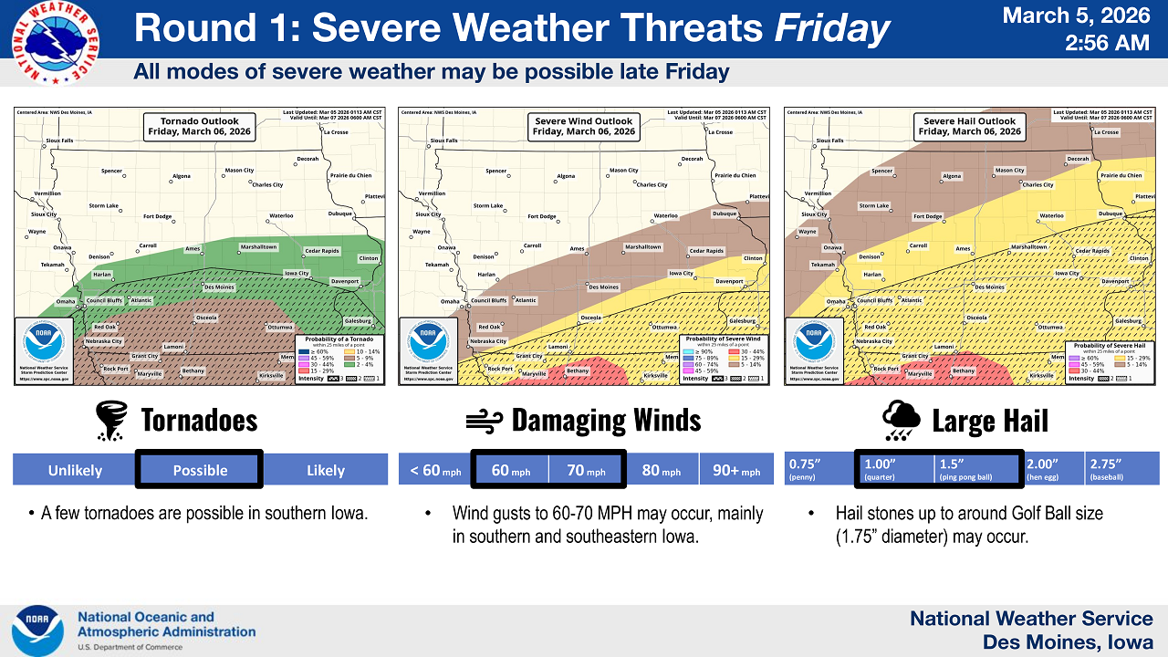
A second round of storms is expected Friday afternoon and evening, roughly between 3 p.m. and 11 p.m. Forecasters say this round could bring a greater severe weather risk across parts of the state. The main threats will include damaging wind gusts of 60 to 70 miles per hour and large hail that could reach golf ball size. A few tornadoes may also be possible, particularly in southern Iowa.
Storms during the second round are expected to move quickly toward the east-northeast, potentially at speeds over 50 miles per hour, which could cause conditions to change rapidly.
The National Weather Service is urging Iowans to remain weather aware and have multiple ways to receive warnings, such as NOAA Weather Radio, mobile weather apps with alerts, local television or radio broadcasts, and wireless emergency alerts on smartphones.
Forecasters plan to provide additional updates as conditions develop.

Stay Connected with KCHA News
Add KCHA News as a preferred source on Google to see more local news, weather, and sports in your feed.
Follow us on Facebook for breaking news, severe weather alerts, sports, and more.
