



Local News
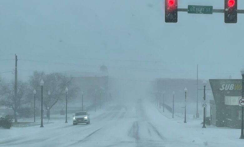
Blizzard Warning Area Expands Across North Central, Northeast Iowa (Noon Update 12.28)

URGENT - WINTER WEATHER MESSAGE
National Weather Service La Crosse WI
827 AM CST Sun Dec 28 2025

...WINTER STORM BRINGS HAZARDOUS TRAVEL THIS AFTERNOON INTO MONDAY
MORNING...

.A potent winter storm brings widespread moderate to heavy snow and
strong northwest winds gusting near 45 mph. Blowing and drifting
snow will result in blizzard conditions for open and unsheltered
locations of southeast Minnesota and northeast Iowa.

Initial rain quickly switches to snow from west to east through the
afternoon hours with snowfall rates in excess of 1" per hour
possible through the evening hours.

Rapidly decreasing temperatures through the afternoon will freeze
standing water and untreated wet surfaces.

Travel will be hazardous to treacherous for many locations and
dangerous in others where blowing and drifting is widespread. Be
prepared to alter or cancel travel plans.

IAZ008-009-018-019-MNZ086-087-094-095-282230-
/O.CON.KARX.BZ.W.0004.251228T1800Z-251229T1500Z/
Mitchell-Howard-Floyd-Chickasaw-Dodge-Olmsted-Mower-Fillmore-
Including the cities of Austin, Cresco, Charles City, Osage,
Preston, Dodge Center, New Hampton, and Rochester
827 AM CST Sun Dec 28 2025

...BLIZZARD WARNING REMAINS IN EFFECT FROM NOON TODAY TO 9 AM CST
MONDAY...

* WHAT...Blizzard conditions expected. Total snow accumulations
  between 4 and 7 inches. Winds gusting as high as 45 mph.

* WHERE...Portions of north central and northeast Iowa and southeast
  Minnesota.

* WHEN...From noon today to 9 AM CST Monday.

* IMPACTS...Visibilities may drop below 1/4 mile due to falling and
  blowing snow. Travel could be very difficult. Widespread blowing
  snow could significantly reduce visibility. The hazardous
  conditions could impact the Monday morning commute. Gusty winds
  could bring down tree branches.

PRECAUTIONARY/PREPAREDNESS ACTIONS...

Travel should be restricted to emergencies only. If you must travel,
have a winter survival kit with you. If you get stranded, stay with
your vehicle. In Iowa, visit 511ia.org for road conditions. In
Minnesota, visit 511mn.org for road conditions.
URGENT - WINTER WEATHER MESSAGE
National Weather Service La Crosse WI
827 AM CST Sun Dec 28 2025

...WINTER STORM BRINGS HAZARDOUS TRAVEL THIS AFTERNOON INTO MONDAY
MORNING...

.A potent winter storm brings widespread moderate to heavy snow and
strong northwest winds gusting near 45 mph. Blowing and drifting
snow will result in blizzard conditions for open and unsheltered
locations of southeast Minnesota and northeast Iowa.

Initial rain quickly switches to snow from west to east through the
afternoon hours with snowfall rates in excess of 1" per hour
possible through the evening hours.

Rapidly decreasing temperatures through the afternoon will freeze
standing water and untreated wet surfaces.

Travel will be hazardous to treacherous for many locations and
dangerous in others where blowing and drifting is widespread. Be
prepared to alter or cancel travel plans.

IAZ029-282230-
/O.UPG.KARX.WW.Y.0021.251228T2100Z-251229T1800Z/
/O.EXA.KARX.BZ.W.0004.251228T1800Z-251229T1500Z/
Fayette-
Including the cities of Oelwein
827 AM CST Sun Dec 28 2025

...BLIZZARD WARNING IN EFFECT FROM NOON TODAY TO 9 AM CST MONDAY...

* WHAT...Blizzard conditions expected. Total snow accumulations
  between 3 and 5 inches. Winds gusting as high as 45 mph.

* WHERE...Fayette County.

* WHEN...From noon today to 9 AM CST Monday.

* IMPACTS...Plan on slippery road conditions. Widespread blowing
  snow could significantly reduce visibility. The hazardous
  conditions could impact the Monday morning commute. Gusty winds
  could bring down tree branches.

PRECAUTIONARY/PREPAREDNESS ACTIONS...

Travel should be restricted to emergencies only. If you must travel,
have a winter survival kit with you. If you get stranded, stay with
your vehicle. Visit 511ia.org for road conditions.
URGENT - WINTER WEATHER MESSAGE
National Weather Service La Crosse WI
827 AM CST Sun Dec 28 2025

...WINTER STORM BRINGS HAZARDOUS TRAVEL THIS AFTERNOON INTO MONDAY
MORNING...

.A potent winter storm brings widespread moderate to heavy snow and
strong northwest winds gusting near 45 mph. Blowing and drifting
snow will result in blizzard conditions for open and unsheltered
locations of southeast Minnesota and northeast Iowa.

Initial rain quickly switches to snow from west to east through the
afternoon hours with snowfall rates in excess of 1" per hour
possible through the evening hours.

Rapidly decreasing temperatures through the afternoon will freeze
standing water and untreated wet surfaces.

Travel will be hazardous to treacherous for many locations and
dangerous in others where blowing and drifting is widespread. Be
prepared to alter or cancel travel plans.

IAZ010-282230-
/O.UPG.KARX.WS.W.0008.251228T2100Z-251229T1800Z/
/O.EXA.KARX.BZ.W.0004.251228T1800Z-251229T1500Z/
Winneshiek-
Including the cities of Decorah
827 AM CST Sun Dec 28 2025

...BLIZZARD WARNING IN EFFECT FROM NOON TODAY TO 9 AM CST MONDAY...

* WHAT...Blizzard conditions expected. Total snow accumulations
  between 4 and 6 inches. Winds gusting as high as 45 mph.

* WHERE...Winneshiek County.

* WHEN...From noon today to 9 AM CST Monday.

* IMPACTS...Plan on slippery road conditions. Widespread blowing
  snow could significantly reduce visibility. The hazardous
  conditions could impact the Monday morning commute. Gusty winds
  could bring down tree branches.

PRECAUTIONARY/PREPAREDNESS ACTIONS...

Travel should be restricted to emergencies only. If you must travel,
have a winter survival kit with you. If you get stranded, stay with
your vehicle. Visit 511ia.org for road conditions.
URGENT - WINTER WEATHER MESSAGE
National Weather Service Des Moines IA
1056 AM CST Sun Dec 28 2025

...STRONG WINDS, SNOW, AND FALLING TEMPERATURES LEADING TO
HAZARDOUS TRAVEL TODAY...

.Strong winds combined with bands of snow moving through central into
northern Iowa are producing sharp drops in visibility. Heaviest snow
amounts are expected in northern Iowa, as snow will continue the
longest in these areas, resulting in prolonged periods of blizzard
conditions. Farther south into north central and central Iowa, rain
will transition to snow as temperatures drop below freezing,
resulting in re-freeze potential. Similarly, bursts of snow will
lead to short durations of visibility under a mile, which combined
with freezing roads could make travel dangerous. Accumulations will
be less in the Advisory areas, with visibility drops only present
with falling snow.

IAZ004>007-015>017-024>028-290300-
/O.CON.KDMX.BZ.W.0005.000000T0000Z-251229T1500Z/
Emmet-Kossuth-Winnebago-Worth-Palo Alto-Hancock-Cerro Gordo-
Humboldt-Wright-Franklin-Butler-Bremer-
Including the cities of Clarksville, Emmetsburg, Allison,
Estherville, Humboldt, Waverly, Algona, Shell Rock, Dumont,
Parkersburg, Britt, Clear Lake, Eagle Grove, Lake Mills,
Aplington, Hampton, Clarion, Forest City, Mason City, Garner,
Greene, Kanawha, Manly, Belmond, and Northwood
1056 AM CST Sun Dec 28 2025

...BLIZZARD WARNING REMAINS IN EFFECT UNTIL 9 AM CST MONDAY...

* WHAT...Blizzard conditions. Additional snow accumulations between
  3 and 5 inches and ice accumulations around a light glaze. Winds
  gusting as high as 60 mph.

* WHERE...Much of northern Iowa.

* WHEN...Until 9 AM CST Monday.

* IMPACTS...Plan on slippery road conditions. Widespread blowing
  snow could significantly reduce visibility. The hazardous
  conditions could impact the Monday morning commute. Gusty winds
  could bring down tree branches.

PRECAUTIONARY/PREPAREDNESS ACTIONS...

Travel should be restricted to emergencies only. If you must travel,
have a winter survival kit with you. If you get stranded, stay with
your vehicle.

For the latest travel conditions, check the Iowa 511 app,
www.511ia.org, or dial 511.
URGENT - WINTER WEATHER MESSAGE
National Weather Service La Crosse WI
827 AM CST Sun Dec 28 2025

...WINTER STORM BRINGS HAZARDOUS TRAVEL THIS AFTERNOON INTO MONDAY
MORNING...

.A potent winter storm brings widespread moderate to heavy snow and
strong northwest winds gusting near 45 mph. Blowing and drifting
snow will result in blizzard conditions for open and unsheltered
locations of southeast Minnesota and northeast Iowa.

Initial rain quickly switches to snow from west to east through the
afternoon hours with snowfall rates in excess of 1" per hour
possible through the evening hours.

Rapidly decreasing temperatures through the afternoon will freeze
standing water and untreated wet surfaces.

Travel will be hazardous to treacherous for many locations and
dangerous in others where blowing and drifting is widespread. Be
prepared to alter or cancel travel plans.

IAZ011-MNZ096-WIZ017-029-033-034-041>044-053-054-282230-
/O.CON.KARX.WS.W.0008.251228T2100Z-251229T1800Z/
Allamakee-Houston-Taylor-Clark-Trempealeau-Jackson-La Crosse-
Monroe-Juneau-Adams-Vernon-Crawford-
Including the cities of La Crosse, Mauston, Tomah, Friendship,
Black River Falls, Viroqua, Caledonia, Neillsville, Whitehall,
Medford, Waukon, Arcadia, Sparta, and Prairie Du Chien
827 AM CST Sun Dec 28 2025

...WINTER STORM WARNING REMAINS IN EFFECT FROM 3 PM THIS AFTERNOON
TO NOON CST MONDAY...

* WHAT...Heavy snow expected. Total snow accumulations between 4 and
  7 inches. Winds gusting as high as 45 mph.

* WHERE...Portions of northeast Iowa, southeast Minnesota, and
  central, north central, southwest, and west central Wisconsin.

* WHEN...From 3 PM this afternoon to noon CST Monday.

* IMPACTS...Travel could be very difficult. The hazardous conditions
  could impact the Monday morning commute. Gusty winds could bring
  down tree branches.

PRECAUTIONARY/PREPAREDNESS ACTIONS...

If you must travel, keep an extra flashlight, food, and water in
your vehicle in case of an emergency. In Iowa, visit 511ia.org for
road conditions. In Minnesota, visit 511mn.org for road conditions.
In Wisconsin, visit 511wi.gov for road conditions.
SNOW SQUALL WARNING
NWS DES MOINES IA
1245 PM CST SUN DEC 28 2025

IAC013-075-099-127-157-171-281915-
/O.NEW.KDMX.SQ.W.0010.251228T1845Z-251228T1915Z/
1245 PM CST SUN DEC 28 2025
Black Hawk County-Grundy County-Jasper County-Marshall
County-Poweshiek County-Tama County-

The National Weather Service in Des Moines has issued a

* Snow Squall Warning for...
Northwestern Poweshiek County in central Iowa...
Eastern Marshall County in central Iowa...
Southwestern Black Hawk County in northeastern Iowa...
Western Tama County in central Iowa...
Grundy County in central Iowa...
Central Jasper County in central Iowa...

* Until 115 PM CST.

* At 1245 PM CST, a dangerous snow squall was located along a line
extending from 4 miles west of Uni-Dome And McLeod Center to near
Le Grand to near Reasnor, moving east at 30 mph.

HAZARD...Whiteout conditions with near zero visibility associated
with intense bursts of heavy snow and gusty winds leading
to blowing snow. Wind gusts greater than 45 mph.

SOURCE...Radar and webcams.

IMPACT...Dangerous and life-threatening travel conditions are
expected to develop rapidly in the warning area.

This includes Interstate 80 between mile markers 158 and 184.

Locations impacted include...
Waterloo, Cedar Falls, Marshalltown, Newton, Grinnell, Grundy Center,
Toledo, Tama, Hudson, Traer, Prairie City, Reinbeck, Dike, Conrad,
Iowa Speedway, Meskwaki Casino, Uni-Dome And McLeod Center, Rock
Creek Lake, Waterloo Municipal Airport, and Gladbrook.

PRECAUTIONARY/PREPAREDNESS ACTIONS...

Slow Down! Rapid changes in visibility and road conditions are
expected with this dangerous snow squall. Be alert for sudden
whiteout conditions.

LAT...LON 4208 9249 4158 9274 4157 9325 4205 9302
          4256 9286 4255 9230 4208 9249

SNOW SQUALL...OBSERVED
SNOW SQUALL IMPACT...SIGNIFICANT
Stay Connected with KCHA News
Add KCHA News as a preferred source on Google to see more local news, weather, and sports in your feed.
Follow us on Facebook for breaking news, severe weather alerts, sports, and more.

