



Severe Storms Possible Tonight Across Iowa, Large Hail Main Threat

DES MOINES, Iowa (NorthIowaNow) — Severe thunderstorms are expected to develop across parts of Iowa Monday evening, with large hail posing the greatest threat, according to the National Weather Service in Des Moines.
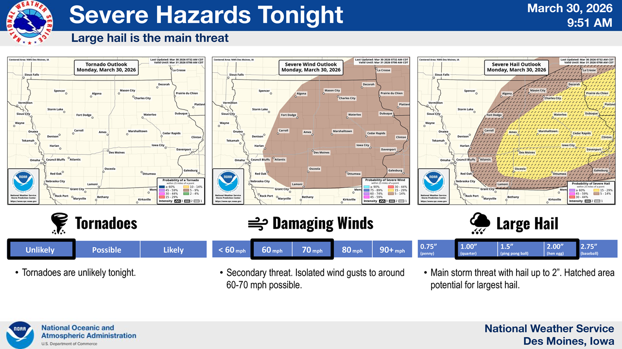
Forecasters say a Slight Risk (Level 2 of 5) for severe weather is in place for portions of central and eastern Iowa tonight, including areas of north-central Iowa. Storms are expected to intensify between 7 p.m. and midnight, when the strongest activity is most likely.
The primary concern with these storms is large hail, potentially up to 2 inches in diameter, which could cause damage to vehicles, crops, and property. Damaging wind gusts of 60 to 70 mph are also possible, though considered a secondary threat. Tornadoes are not expected to be a major concern with this system.
Ahead of the storms, much of Iowa will experience near-record warmth and elevated fire danger, especially across southern and western parts of the state.
Storm Chances Continue Tuesday
The unsettled weather pattern will continue into Tuesday, with additional thunderstorms possible during the afternoon and evening. Parts of eastern Iowa are under a Marginal Risk (Level 1 of 5) for severe weather.
A few storms Tuesday could again produce hail and gusty winds, though widespread severe weather is not expected.
Cooler Temperatures and Gusty Winds Follow
A cold front moving through the state Tuesday will bring a noticeable change in conditions. Winds will shift from the south to the north, increasing to 15 to 20 mph with gusts up to 30–35 mph.
Temperatures will vary across the state, with northern Iowa seeing highs in the upper 50s while southern Iowa approaches 80 degrees before temperatures fall later in the day.
By Tuesday night, a widespread cooldown is expected, with lows dropping into the mid-30s statewide.
What to Watch
Residents are encouraged to stay weather-aware Monday evening, particularly during peak storm hours. Large hail could develop quickly, and warnings may be issued with little lead time.
Stay with NorthIowaNow for the latest updates as conditions evolve.

Stay Connected with KCHA News
Add KCHA News as a preferred source on Google to see more local news, weather, and sports in your feed.
Follow us on Facebook for breaking news, severe weather alerts, sports, and more.
