



Strong Storms Expected Across North Iowa Again Today, More Rounds Possible Through Week
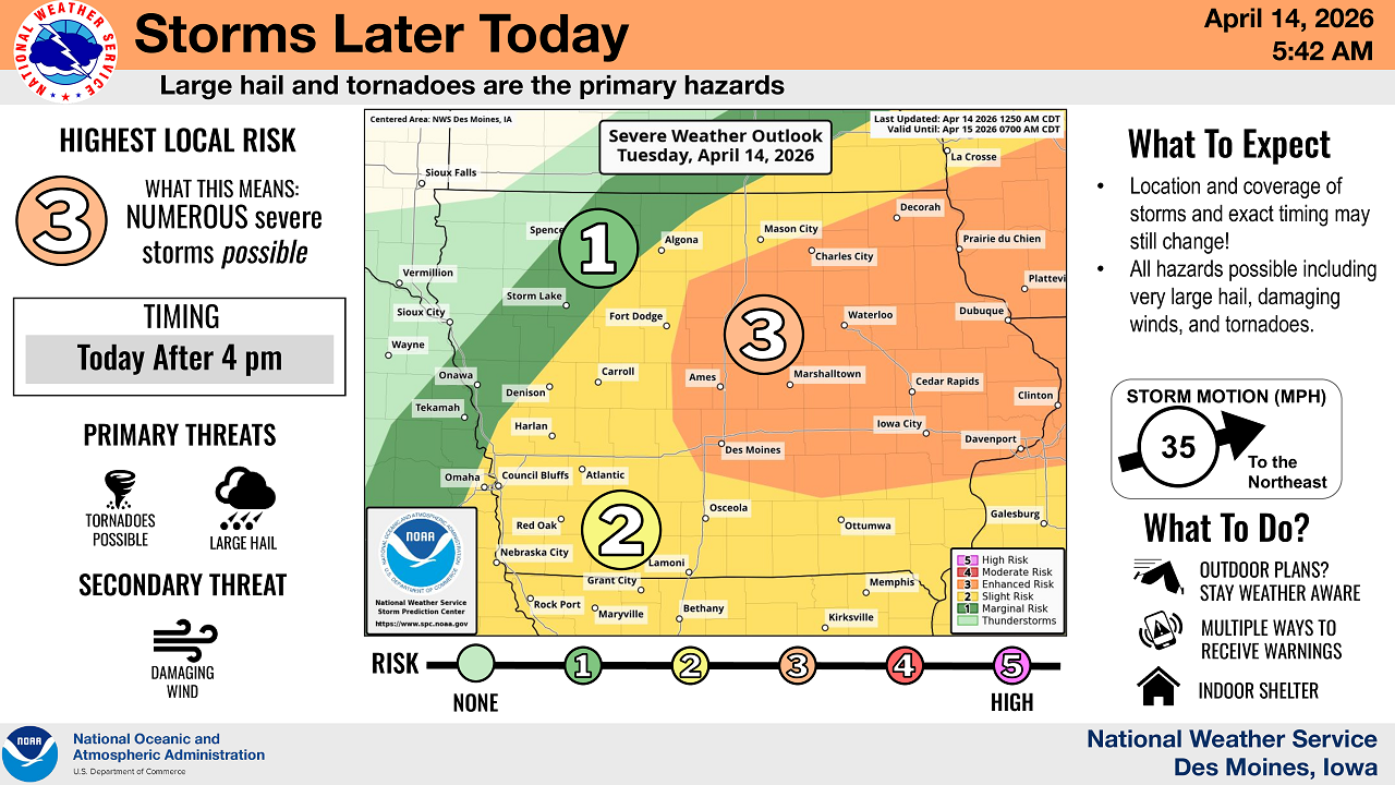
DES MOINES, Iowa (NorthIowaNow) — North Iowa is bracing for multiple rounds of severe weather beginning late Tuesday afternoon, with large hail and tornadoes posing the greatest threats, according to the National Weather Service.
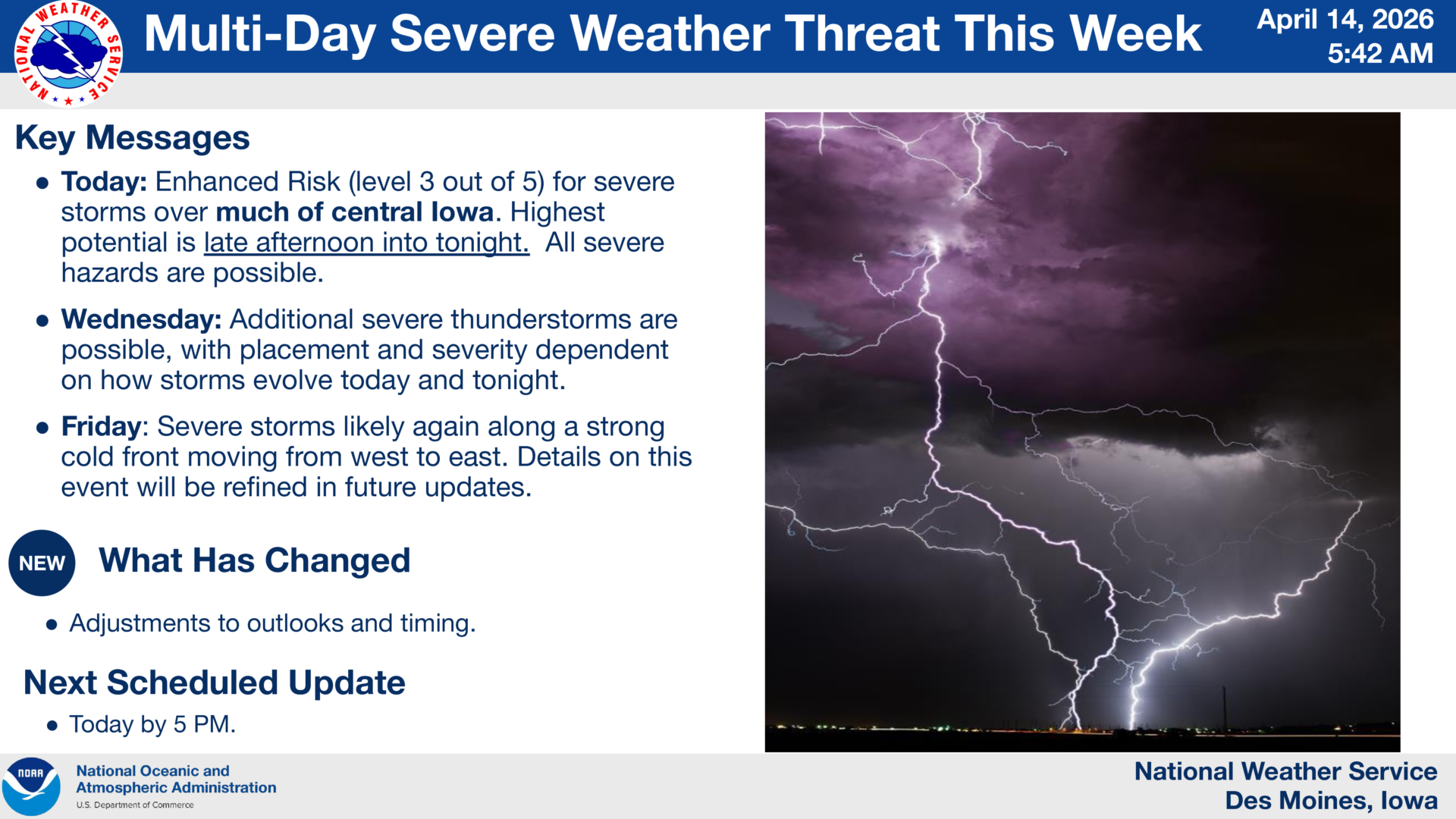
Forecasters say storms are expected to develop after 4 p.m. Tuesday, with a Level 3 (Enhanced) risk in parts of central and eastern Iowa and a Level 1–2 risk extending into northern Iowa.
Tuesday’s Main Threats
The primary concerns with today’s storms include:
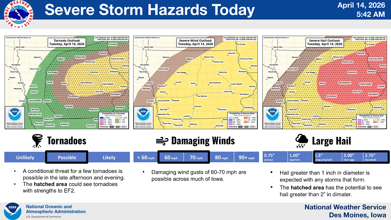
- Large hail, potentially exceeding 1 inch in diameter
- Damaging winds up to 60–70 mph
- A few tornadoes, some possibly reaching EF2 strength in the most favorable areas
Meteorologists say the tornado threat remains conditional, but cannot be ruled out, especially during the late afternoon and evening hours.
Storms are expected to move quickly to the northeast at around 35 mph, meaning conditions could change rapidly.
Wednesday Brings Another Round
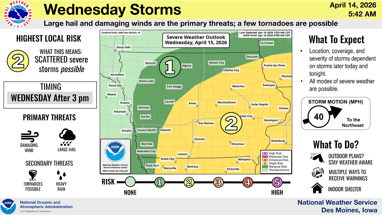
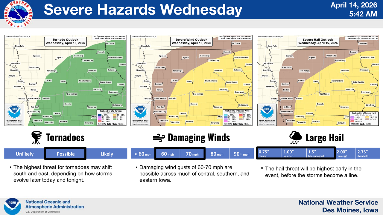
The unsettled pattern continues Wednesday, with storms expected to redevelop after 3 p.m.
While the overall risk lowers slightly to a Level 2 (Slight Risk), hazards remain similar:
- Damaging winds and large hail as primary threats
- A few tornadoes still possible
Forecasters note that Wednesday’s severity will depend heavily on how Tuesday’s storms evolve.
Friday Storm System Ahead
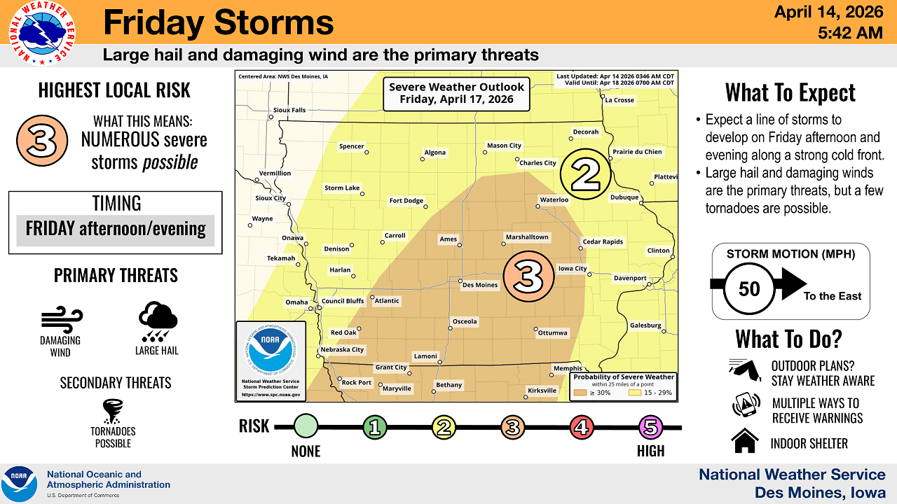
Another, potentially more organized system is expected Friday afternoon and evening along a strong cold front.
That round carries a Level 3 risk, with:
- Large hail and damaging winds as the main threats
- A continued chance for isolated tornadoes
Storms on Friday are expected to move faster, around 50 mph, increasing the risk for widespread impacts.
Flooding Concerns Increasing
In addition to severe storms, localized flooding is becoming a concern across Iowa.
The National Weather Service says multiple rounds of moderate to heavy rain could bring:
- 1 to 2+ inches of rainfall in some areas
- Minor river rises and localized flash flooding
At this time, the flooding risk is considered low-end but increasing, especially in areas that receive repeated storms.
Stay Weather Aware
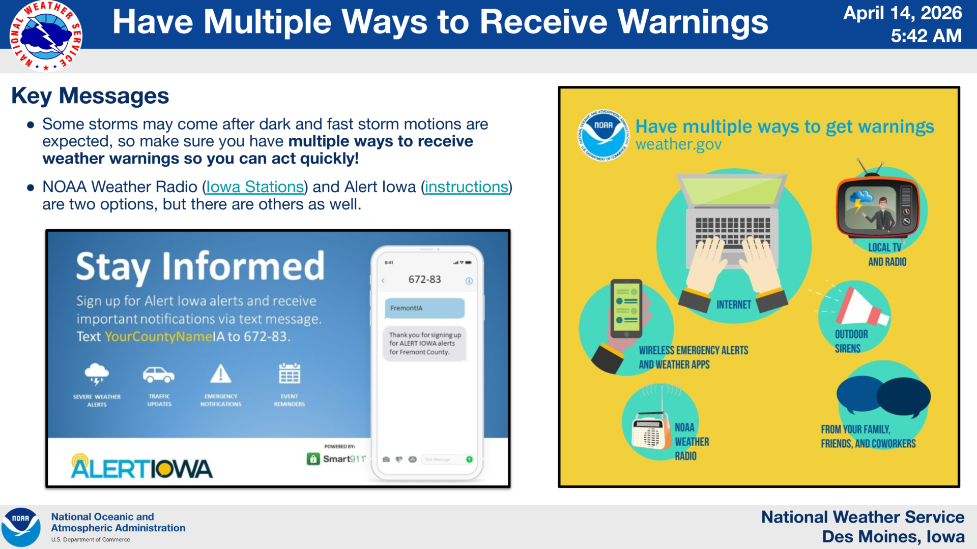
Officials urge residents to stay alert, particularly as some storms may occur after dark.
Recommended safety steps include:
- Have multiple ways to receive warnings, including NOAA Weather Radio and mobile alerts
- Review shelter plans ahead of storms
- Be prepared to move indoors quickly if warnings are issued
“Storm timing and exact impacts may still change,” the Weather Service said, “but all hazards will be possible with storms that develop.”
Residents across North Iowa are encouraged to monitor the latest forecasts throughout the day as conditions evolve.

Stay Connected with KCHA News
Add KCHA News as a preferred source on Google to see more local news, weather, and sports in your feed.
Follow us on Facebook for breaking news, severe weather alerts, sports, and more.
