



Extreme Heat, Severe Storm Threat to Grip North Iowa Through Holiday Weekend
Heat index values could top 100 degrees as National Weather Service warns of flash flooding and tornado risk in Mason City area

MASON CITY, Iowa — Dangerous heat and rounds of severe thunderstorms are set to hammer North Iowa this week, with the National Weather Service warning that repeated storms over the same areas could trigger flash flooding heading into the Fourth of July holiday weekend.
The Weather Service office in Des Moines issued an Extreme Heat Warning for much of central, southern and eastern Iowa Wednesday morning, while Mason City, Algona and surrounding North Iowa communities remain under a Heat Advisory. Forecasters say heat index values will climb above 100 degrees, with overnight lows only dropping into the 70s, offering little relief.
What’s changed
In its 5:05 a.m. update Wednesday, the Weather Service trimmed several northwestern Iowa counties from the heat headline and downgraded northern Iowa from a warning to an advisory. Forecasters also shifted Wednesday’s enhanced severe weather risk area about one county to the south. The next full update is expected by 5 p.m. Wednesday.
Heat index forecast for Mason City
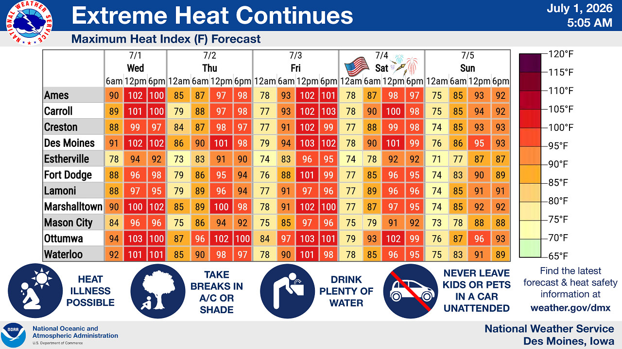
According to National Weather Service data, Mason City’s heat index is expected to peak in the mid-90s Wednesday and climb into the upper 90s later in the week:
- Wednesday, July 1: High of 96
- Thursday, July 2: High of 94
- Friday, July 3: High of 97
- Saturday, July 4: High of 92
- Sunday, July 5: High of 88
Des Moines, Ottumwa and Ames are forecast to see even higher heat index readings, topping out above 100 degrees on multiple days this week.
Severe storms possible Wednesday night, again Thursday
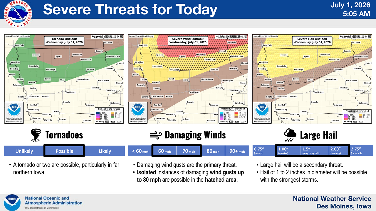
The Weather Service placed North Iowa, including the Mason City and Decorah areas, under its highest local severe weather risk for Wednesday — a level 3 out of 5, meaning numerous severe storms are possible. Storms are expected to develop late Wednesday afternoon and continue into the night, moving northeast at 30 to 40 mph.
Forecasters say the primary threats Wednesday evening include:
- Damaging wind: Gusts of 60 to 70 mph are likely, with isolated gusts up to 80 mph possible in the hardest-hit areas.
- Large hail: Hail 1 to 2 inches in diameter — roughly quarter to ping-pong ball size — will be a secondary threat.
- Tornadoes: A tornado or two is possible, particularly in far northern Iowa.
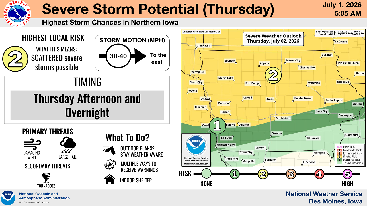
A second, lower-end severe weather risk (level 2 out of 5) is forecast for Thursday afternoon and overnight, again focused on northern Iowa. Damaging wind and large hail remain the main threats Thursday, with tornadoes listed as a secondary risk.
The Weather Service is also warning that successive rounds of thunderstorms tracking over the same communities could lead to flash flooding in towns and cities across the area.
Heat safety tips
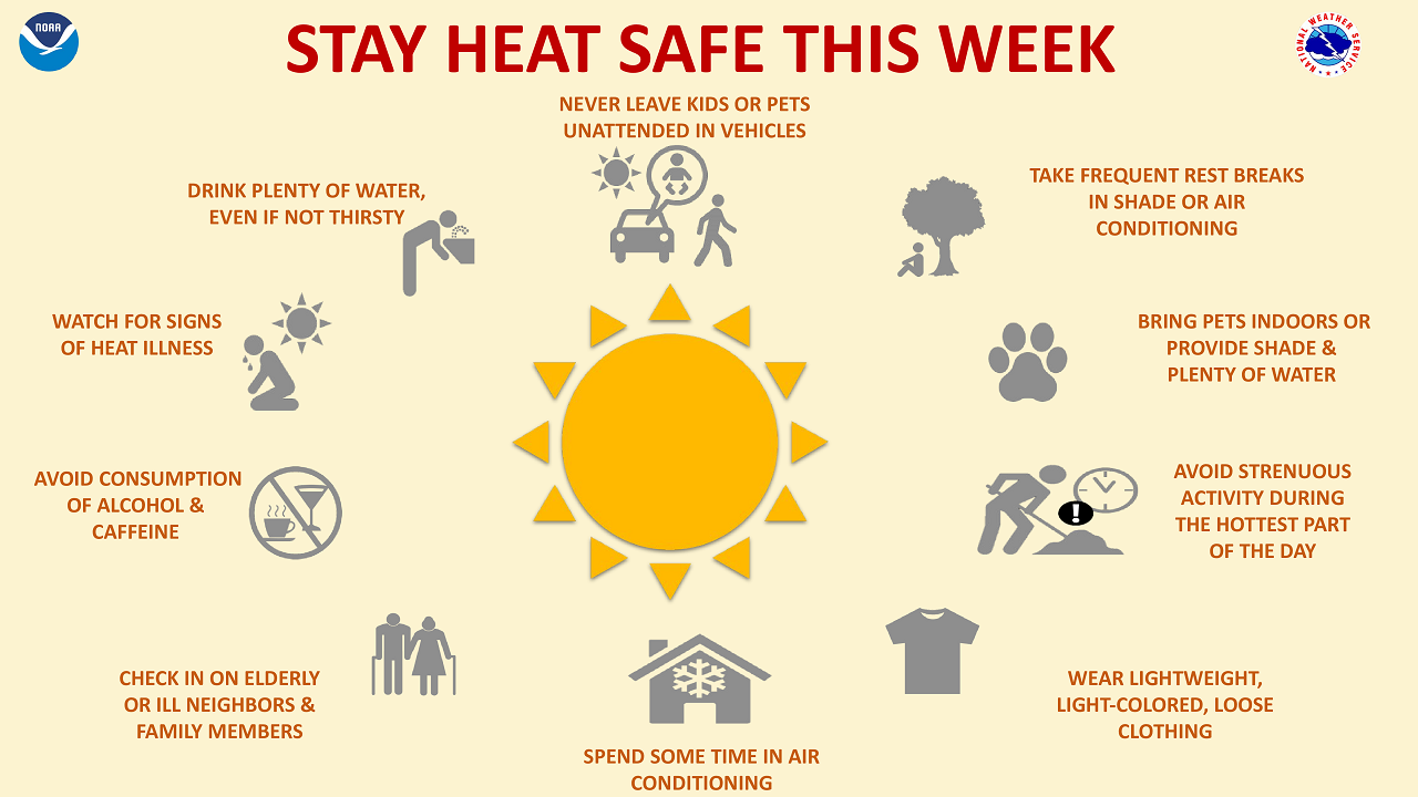
The National Weather Service urged residents to take precautions as dangerously hot and humid conditions persist:
- Drink plenty of water, even if not thirsty
- Take frequent breaks in air conditioning or shade
- Never leave children or pets unattended in vehicles
- Avoid alcohol and caffeine
- Wear lightweight, light-colored, loose-fitting clothing
- Avoid strenuous outdoor activity during the hottest part of the day
- Check on elderly neighbors and family members
- Bring pets indoors or ensure they have shade and water
Residents are encouraged to stay weather-aware and have multiple ways to receive warnings as storms approach.

Stay Connected with KCHA News
Add KCHA News as a preferred source on Google to see more local news, weather, and sports in your feed.
Follow us on Facebook for breaking news, severe weather alerts, sports, and more.
