


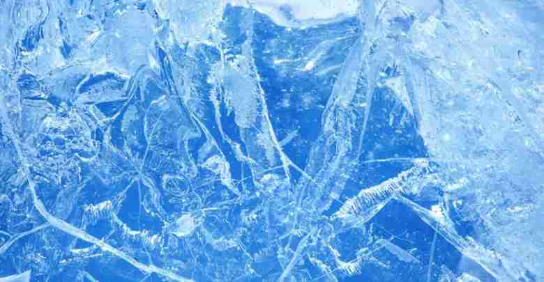
Weather Advisories, Watches, Warnings for Freezing Ice, Mixed Precipitation Vary Across Region
HERE ARE THE LATEST WINTEWEATHER WATCHES, ADVISORIES, WARNINGS FOR NORTH, NORTHEAST IOWA FROM NATIONAL WEATHER SERVICES
URGENT - WINTER WEATHER MESSAGE
National Weather Service La Crosse WI
200 PM CST Mon Jan 2 2023

.A winter storm will impact the area with freezing rain and snow tonight through Tuesday. The precipitation develops this evening, becoming more widespread
overnight, gradually lifting north through the day Tuesday. Warming temperatures from the south should help mitigate impacts later in the day.

Highest impacts and amounts of ice or snow are expected from late tonight through Tuesday morning. The Tuesday morning commute will be impacted.

IAZ008-018-MNZ086-094-030400-
/O.CAN.KARX.IS.W.0001.230103T0000Z-230104T0000Z/
/O.EXA.KARX.WW.Y.0001.230103T0300Z-230104T0000Z/
Mitchell-Floyd-Dodge-Mower-Including the cities of Osage, Charles City, Dodge Center, and Austin
200 PM CST Mon Jan 2 2023

...WINTER WEATHER ADVISORY IN EFFECT FROM 9 PM THIS EVENING TO 6 PM CST TUESDAY...ICE STORM WARNING IS CANCELLED...

* WHAT...Mixed precipitation expected. Total snow accumulations of up to one inch and ice accumulations of one tenth to two tenths of an inch.

* WHERE...In Iowa, Mitchell and Floyd Counties. In Minnesota,  Dodge and Mower Counties.

* WHEN...From 9 PM this evening to 6 PM CST Tuesday.

* IMPACTS...Plan on slippery road conditions. The hazardous conditions could impact the morning or evening commute.

* ADDITIONAL DETAILS...There remains the potential for this storm to shift north or south. Travelers are urged to keep up  to date with the latest
  forecasts and statements concerning this potentially hazardous travel situation.

PRECAUTIONARY/PREPAREDNESS ACTIONS...Slow down and use caution while traveling.

In Iowa, visit 511ia.org for road conditions. In Minnesota, visit 511mn.org for road conditions.
URGENT - WINTER WEATHER MESSAGE
National Weather Service La Crosse WI
200 PM CST Mon Jan 2 2023

.A winter storm will impact the area with freezing rain and snow tonight through Tuesday. The precipitation develops this evening, becoming more
widespread overnight, gradually lifting north through the day Tuesday. Warming temperatures from the south should help mitigate impacts later in the day.

Highest impacts and amounts of ice or snow are expected from late tonight through Tuesday morning. The Tuesday morning commute will be impacted.

IAZ009-019-MNZ079-087-088-095-WIZ017-029-032>034-030400-
/O.CON.KARX.WW.Y.0001.230103T0300Z-230104T0000Z/
Howard-Chickasaw-Wabasha-Olmsted-Winona-Fillmore-Taylor-Clark-Buffalo-Trempealeau-Jackson-Including the cities of Cresco, New Hampton, Wabasha, Rochester,
Winona, Preston, Medford, Neillsville, Alma, Arcadia, Whitehall, and Black River Falls
200 PM CST Mon Jan 2 2023

...WINTER WEATHER ADVISORY REMAINS IN EFFECT FROM 9 PM THIS EVENING TO 6 PM CST TUESDAY...

* WHAT...Mixed precipitation expected. Total snow accumulations of up to one inch and ice accumulations of up to two tenths of an inch.

* WHERE...Portions of northeast Iowa, southeast Minnesota and central, north central and west central Wisconsin.

* WHEN...From 9 PM this evening to 6 PM CST Tuesday.

* IMPACTS...Plan on slippery road conditions. The hazardous conditions could impact the morning or evening commute.


PRECAUTIONARY/PREPAREDNESS ACTIONS...Slow down and use caution while traveling.

In Iowa, visit 511ia.org for road conditions. In Minnesota, visit 511mn.org for road conditions. In Wisconsin, visit 511wi.gov for road conditions.
URGENT – WINTER WEATHER MESSAGE
National Weather Service Des Moines IA
254 PM CST Mon Jan 2 2023
…Significant Ice Storm Tonight into Tuesday…
.A winter storm will spread mixed precipitation across about the northwest half of Iowa and neighboring states through tonight and into Tuesday. Much of the precipitation will fall as freezing rain from northwest into north central areas, with a mix of light snow at times. Significant ice accumulations are possible, resulting in treacherous travel conditions and potentially power outages. During the day Tuesday the precipitation will become lighter and end or change to rain in many areas, however, another round of wintry mix followed by widespread light to moderate snow is expected from Tuesday night through Wednesday.
IAZ004>007-015>017-023>026-033>035-044-045-030500-
/O.CON.KDMX.IS.W.0001.230103T0000Z-230104T0000Z/
Emmet-Kossuth-Winnebago-Worth-Palo Alto-Hancock-Cerro Gordo- Pocahontas-Humboldt-Wright-Franklin-Sac-Calhoun-Webster-Crawford- Carroll- Including the cities of Estherville, Algona, Forest City, Lake Mills, Northwood, Manly, Emmetsburg, Garner, Britt, Kanawha, Mason City, Clear Lake, Pocahontas, Laurens, Rolfe, Fonda, Gilmore City, Humboldt, Eagle Grove, Clarion, Belmond, Hampton, Sac City, Lake View, Odebolt, Wall Lake, Schaller, Early, Rockwell City, Manson, Lake City, Pomeroy, Fort Dodge, Denison, and Carroll
254 PM CST Mon Jan 2 2023
...ICE STORM WARNING REMAINS IN EFFECT FROM 6 PM THIS EVENING TO 6 PM CST TUESDAY...
* WHAT…Significant icing expected. Total ice accumulations of one quarter to one half of an inch and snow accumulations of one to two inches through Tuesday afternoon. Winds gusting as high as 30 mph at times.
* WHERE…Western into northern Iowa.
* WHEN…From 6 PM this evening to 6 PM CST Tuesday.
* IMPACTS…Power outages and tree damage are likely due to the ice. Travel could be very treacherous. The hazardous conditions could impact the Monday evening and Tuesday morning
commutes.
PRECAUTIONARY/PREPAREDNESS ACTIONS…
Travel is strongly discouraged. If you must travel, keep an extra flashlight, food and water in your vehicle in case of an emergency. Prepare for possible power outages.
For the latest travel conditions, check the Iowa 511 app, www.511ia.org, or dial 511.
URGENT - WINTER WEATHER MESSAGE
National Weather Service Des Moines IA
254 PM CST Mon Jan 2 2023

...Significant Ice Storm Tonight into Tuesday...

.A winter storm will spread mixed precipitation across about the northwest half of Iowa and neighboring states through tonight and into Tuesday. Much of
the precipitation will fall as freezing rain from northwest into north central areas, with a mix of light snow at times. Significant ice accumulations
are  possible, resulting in treacherous travel conditions and potentially power outages. During the day Tuesday the precipitation will become lighter
and end or change to rain in many areas, however, another round of wintry mix followed by widespread light to moderate snow is expected from Tuesday
night through Wednesday.

IAZ027-028-036>038-046-047-057-058-030500-
/O.CON.KDMX.WW.Y.0001.230103T0000Z-230104T0000Z/
Butler-Bremer-Hamilton-Hardin-Grundy-Greene-Boone-Audubon-Guthrie- Including the cities of Parkersburg, Clarksville, Shell Rock, Greene, Aplington,
Allison, Dumont, Waverly, Webster City, Iowa Falls, Eldora, Ackley, Grundy Center, Reinbeck, Conrad, Dike, Wellsburg, Jefferson, Boone, Audubon, Exira,
Guthrie Center, Panora, Bayard, and Casey
254 PM CST Mon Jan 2 2023

...WINTER WEATHER ADVISORY REMAINS IN EFFECT FROM 6 PM THIS EVENING TO 6 PM CST TUESDAY...

* WHAT...Mixed precipitation expected. Ice accumulations of up to a quarter of an inch are possible.

* WHERE...Portions of west central into northeastern Iowa.

* WHEN...From 6 PM this evening to 6 PM CST Tuesday.

* IMPACTS...Travel could be treacherous. The hazardous conditions could impact the Monday evening and Tuesday morning commutes.

PRECAUTIONARY/PREPAREDNESS ACTIONS...

Slow down and use caution while traveling. For the latest travel conditions, check the Iowa 511 app, www.511ia.org, or dial 511.